Collins Children's World Map design
Part of the brief to redesign and illustrate the new Collins Primary Maths title was to also create a new World Map.
Here are the stages I went through to the final product.
I used the map artwork from the internal pages of the atlas for the wall map skeleton. Collins then sent me a detailed reference map with all capital cities and other major cities marked for inclusion.
Here is an early draft of the wall map. The key is at an early stage design. Kevin Robbins, Head Designer at Collins Glasgow, and I discussed making this more of a feature.
After a few small changes I sent Collins a first draft.
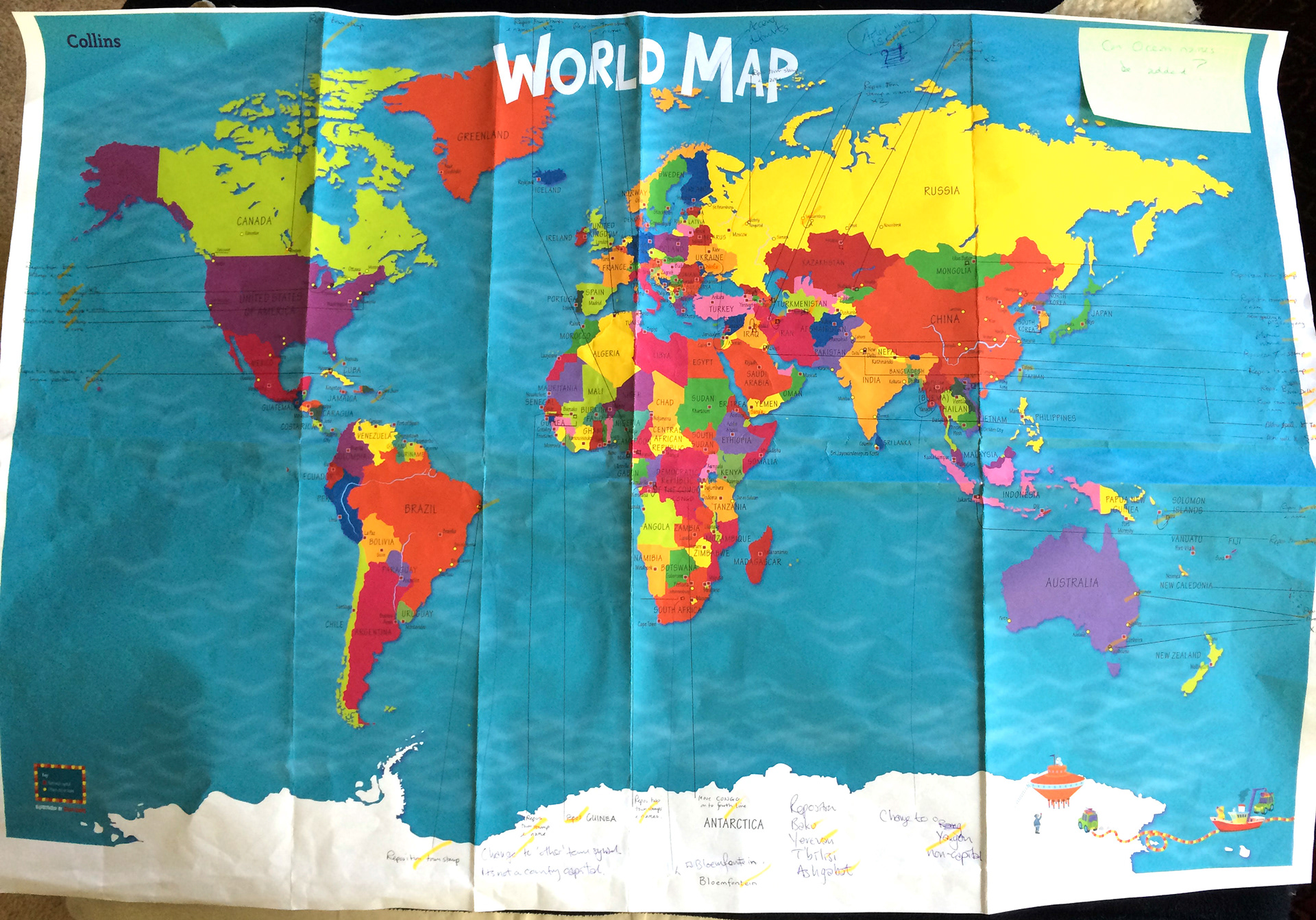
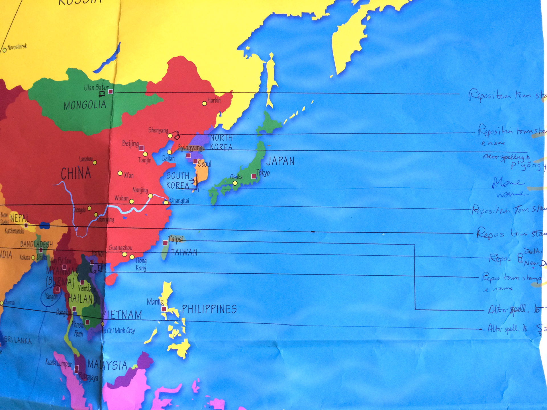
Collins thought it more practical to send me a marked hard copy of the first draft which someone had gone through with a fine tooth comb to make sure all cities and countries were correctly labelled and in the correct position.
In this version I framed the key with the striped outline used on the cover of the Picture Atlas and for the location maps. I also tried just a white title for the map which later Kevin thought looked like a mistake, the colour had dropped out and looked unfinished. I agreed and I looked at using a colour that wouldn't clash with the various colours used for the surrounding countries. Not an easy task!
Below are close-ups of the marked hard copy showing the detail that Collins went through to make the map as correct as possible.
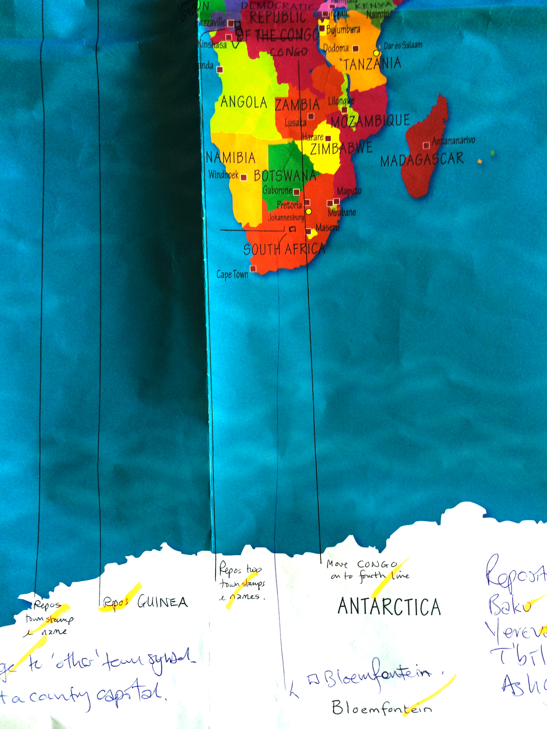
The accuracy the map needed to be is shown in the small changes that were made to position each country name and city markers.
Here is the map with a new title which I added an internal shadow to, to make it stand out.
Also included are reused elements from the Atlas. It was a time consuming task to position each element in relation to each other and to make the whole picture pleasing to the eye as well as making all countries and cities as clear as possible for a child to be able to read.
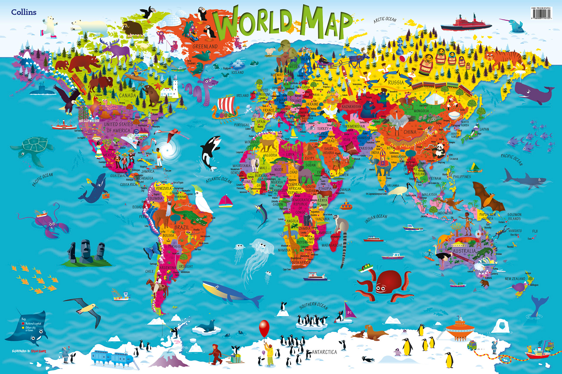
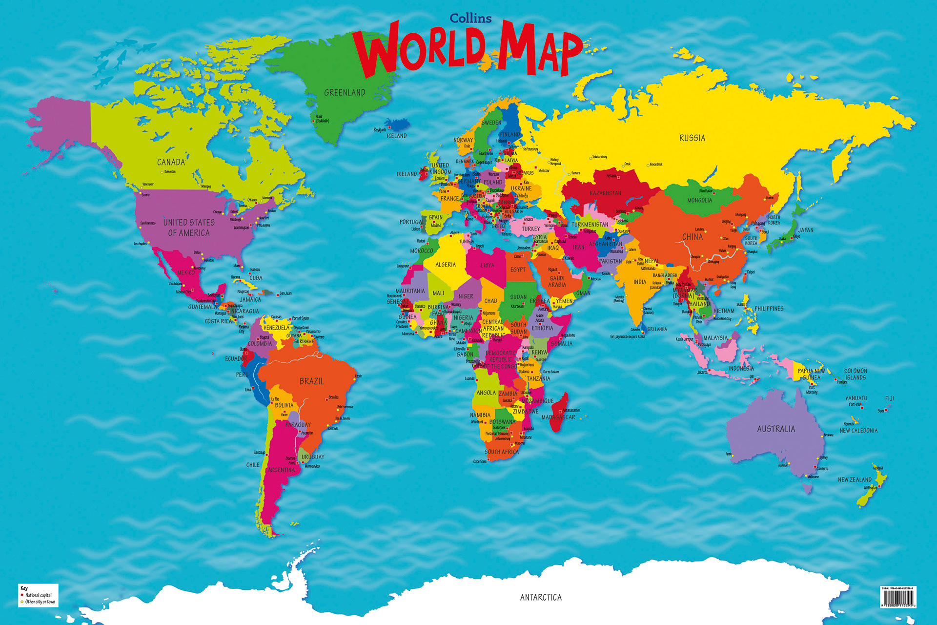
The final design with new title. One of the sales team mentioned that the poster would be rolled length ways. They wanted the customer to see the title along the roll which restricted the height of the text to 40mm. I also changed the colour to yellow with a deep orange outline. I deleted the inner shadow as this made the title too prominent.
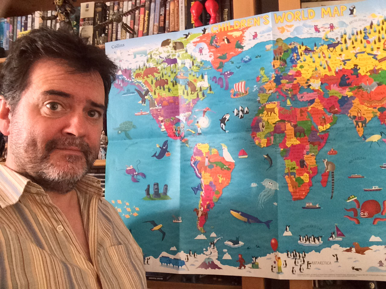
I was pleased to receive an early copy. Kevin apologised for having folded the map but it was included with printouts of the Atlas. Very pleased to see the finished product, not just an image on computer.
The map is available here. From Monday 11th May till 11th June the book and map will be 30% off.
http://www.collins.co.uk/product/9780008114732/Collins+Children%E2%80%99s+World+Map+%5bNew+edition%5d
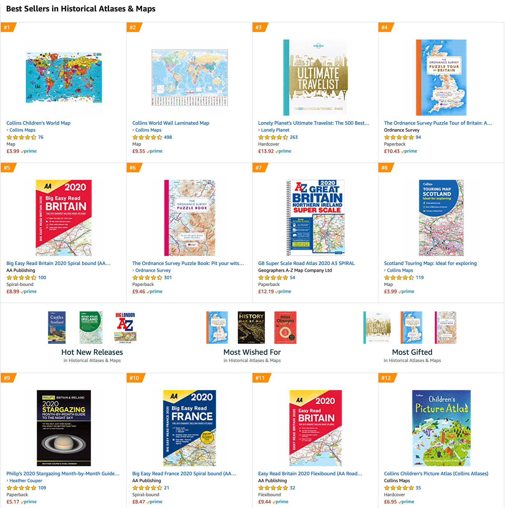
Since launch in 2016 the map has remained the number 1 bestseller in the Amazon Historical Atlases and Maps section. The Atlas remaining at number 12.
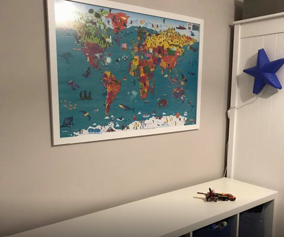
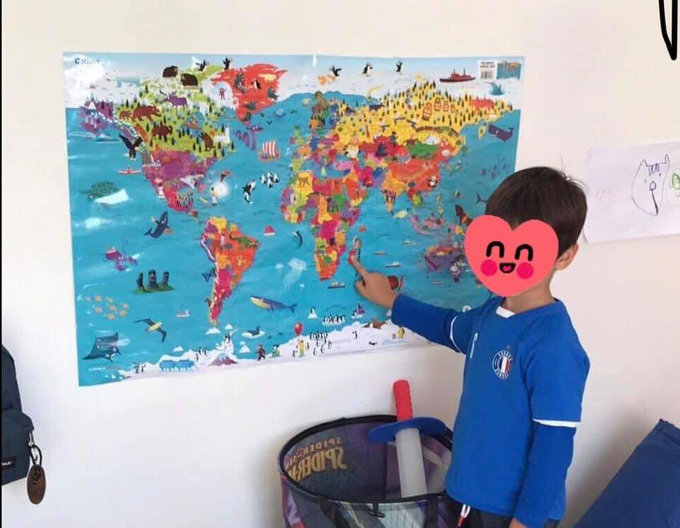
A couple of images from happy Amazon customers.